Monday, December 15, 2014

Cooked by Nature.


  • Ikan Terubuk Masin - The numerous waterways provide the people with an abundance of fresh water fish like the Tilapia, which incidentally is the most widely cultivated.  it's no surprise then that some of the popular Sarawakian dishes also include these 'gifts' from the sea.  The salted ikan terubok is sold in markets around Sarawak.
  • Umai - Umai (Umei), This is a dish for the brave. The umai is traditionally a standard lunch meal for the Melanau fisherman.  Thin slivers of raw fresh fish, usually iced but not frozen, combined with thinly scliced onions, chili, salt and juice from sour fruits like lime or assam go into preparing this dish.  The dish is usually accompanied by a bowl of toasted sago pearls and is so simple that fishermen prepare it easily on their boats.
How to make Umai.
Heard of the term "Umai" before? I guess most Sarawakian would know what does it mean. It is actually a cuisine which is synonym to Melanau people in Sarawak.

I am sure lots of people are quite familiar with Japanese sashimi? Ya! If you know what Japanese sashimi is, then Umai is "Melanau's sashimi"! It is thinly sliced fish either eaten raw by dipped into a specially prepared sauce or marinated with calamondin lime, onions, chillies and some gingers.

Few types of fish can be used to prepare Umai, but the most common one is this Empirang fish with gold body color. It is not too hard to recognize this fish in the market. Why this fish? Well, honestly I am not sure. Maybe is because its flesh textures suitable to make Umai?

Basically preparing Umai is not too hard because at the end of the day, you just need to soak everything together for a short while before you can eat it.However, the hardest part is to prepare the fish! Yes, it certainly needs a very good skills to do so.
  1. To prepare the fish, first of all of course you need to clear and clean the fish. Then the toughest part is here - fillet the fish! If you not use to carry the knife, well I guess it is difficult to do this.
  2. After filleting, it is time to slice the fish into tiny pieces. Make sure you slice the Empirang fish in the correct direction or else you will end up eating sashimi with a lot of fish bones!
  3. and don't forget the calamondin lime juice! It is not easy to prepare as you can imagine how much juice you can get from a tiny calamondin.
  4. Is there any easier way beside using this traditional and out dated technology to squeeze the lime juice? How much juice needed? Well, as long as it is enough to marinate everything in.

  • Mee Deen The unique in Sarawak. If you try only one unique, local food in Kuching, make it midin. Pronounced “mee deen”, midin is a green jungle fern that grows in Sarawak. Apparently this particular fern only grows on the island of Borneo. Unlike other greens that get soft when cooked, midin remains crunchy giving it an enjoyable texture.The natives would pluck the top section of the fern and sell them at the local jungle produce market. I heard that these days people plant them for sale. The thin, curly shoots are a delicious and healthy alternative to noodles and rice. Midin is often stir-fried with garlic, ginger, or optionally shrimp paste and chili.

Some important tips to travel.


Saturday, December 13, 2014

Hills and Mountains in Malaysia also Tips to go hiking.

Broga Hill


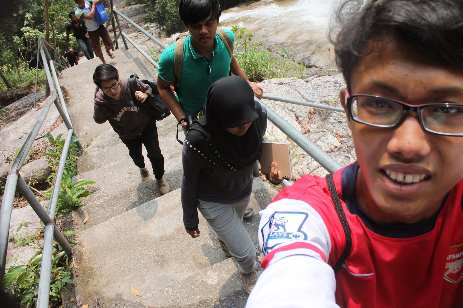
Bukit Broga, also known as 'Bukit Lalang' - after the local species of grass that grows abundantly here, is a hill in Semenyih, at 400 meters high and 40 minutes away from Kuala Lumpur on the trunk road to Broga. It can be reached a short distance later after University of Nottingham, where the entrance starts at left from an oil palm estate opposite a rabbit park. Famed for its incredibly panoramic views (especially at dawn) along with easy accessibility on foot, the hill is a popular tourist attraction among locals; the estate owner cashes on the glut of visitors during weekends and public holidays by charging MYR2 per vehicle that parks on his grounds.

From the peak, visitors get a spacious view of the plains, coated by a mixture of rainforest, oil palm plantations, villages and towns, along with distant mountains. At dawn, mist rising from the ground from the warmth of the sun envelops the landscape in a carpet of white, evoking a surreal atmosphere. The hike while steep is relatively easy, taking anywhere between 20 and 45 minutes to reach the highest peak depending on one's fitness level, or photo stops. There are three peaks in total, each one ascends above the other through a clear path fringed by tall grass at each side. From the summit, a proper jungle trail leads through primary rainforest to Gunung Tok Wan (675 meters), a roughly one and a half hour hike on meandering slopes.


Bukit Putih, Cheras


Bukit Putih is a hill that sits on a forest reserve in Cheras, near Kuala Lumpur. Residents around here frequent this hill throughout whole week, more on weekends. Another peak sits a short distance away from the summit of Bukit Putih; called Bukit Saga, this other hill is more popularly accessed from Taman Saga in Ampang. As most of the hikers are middle-aged to senior citizens, Bukit Putih has earned a popular nickname in Chinese - 'Ah Pak San', which is Chinese slang for old folks, refering to white hair. The trails have moderately challenging ascents and descents; if you were to traverse all the trails, it could easily take up most of the day. 

The outer fringes of the hill are made up of mostly of rubber trees but further in, it transcends to old secondary or primary forest. Despite its proximity to urban areas, Bukit Putih has a surprising number of wildlife living here, including birds, squirrels and monkeys. Forest in Bukit Putih Bukit Putih Waterfall Banded leaf langurs (Presbytis femoralis), a less common species of primate than the long tailed macaque, can easily be spotted perched among the tree tops while hiking here. Locals that live around the hill and use it for recreation have even formed an organisation dedicated to preserving and maintaining the trails and environment. As such, the trails are well-marked with labels and bands to point you in the correct direction while hiking.

The peak of Bukit Putih itself is a clearing with various crude exercise instruments. Over here, many of the senior hikers will congregate to discuss politics, family matters and all things under the sun. The trails lead to different 'stations' or check points around the hill. One of them even takes you to a small but scenic waterfall located down below following a steep descent. To get to Bukit Putih, visitors need to follow the roads leading into Taman Cuepacs in Cheras. Ask around for directions and it will eventually lead you to the trail entrance. In previous years, hikers have collided their heads with local residents due to littering and parking problems. So, if you come by car, park your vehicle along the main roads outside the housing area, and then trek in.

Gunung Nuang, Hulu Langat

Gunung Nuang is the highest mountain of Selangor, at 1,493m with trails that start from either Hulu Langat, Janda Baik (Bukit Tinggi) or Kemensah (Gombak, near Kuala Lumpur). The most popular route is through Hulu Langat, and it is not uncommon to see the trail overrun by people on weekends. For the moderately fit, the duration to reach the peak is a deceptive four to five hours, but only when dry. Significant rainfall will turn major portions of the trail into a mudbath - a demoralising scramble up steep gradients with little traction. Hiking turns to a crawl, and if on the way back, expect heavy segments of sliding.

Many non-seasoned visitors will turn back at this point, if not already at the peak. To climb Nuang using the main route, follow directions towards Hulu Langat on the Cheras highway from Kuala Lumpur. Once you hit the trunk road, follow signboards towards Pangsoon until the entrance of a dam; the trail starts from a park at left. A small fee of MYR1 is levied by the Orang Asli gatekeeper here on weekends. The first part of the climb is an undulating gravel and dirt road walk to reach the foothill. Fringed by secondary growth and bamboo, it's a boring experience with little sights along the way. After an hour, the trail leads into proper jungle, passing through campsites with stream crossings until a steep run all the way up to Puncak Pengasih. From this check-point, the trail is more level until the summit, where a pretty view of mountains, and even Kuala Lumpur and Genting Highlands, await on a clear day.

Gunung Datuk, Rembau


Gunung Datuk is a mountain near Rembau in Negeri Sembilan, named after a local chieftan from ancient times who used the peak as a ceremonial venue to elect clan leaders. At only 883m, it's a steep but brisk hour plus trek for fast climbers to the top, while others may take two to three hours. A MYR5 fee is levied on climbers at the entrance park, which can be reached by passing through an estate from the main road about 21km from Rembau town, or 15km from Tampin. The summit is famous for its panoramic views, including villages and towns stretched across a plane of green towards the coastline facing the Straits of Malacca.


Gunung Angsi, Seremban


Gunung Angsi is a mountain that overlooks Seremban in Negeri Sembilan, about 10km away from the city and situated along the highway to Kuala Pilah. At 825m, its a relatively easy trail if coming via the Bukit Putus route, but moderately harder using the longer (official) trail that starts from Ulu Bendul Recreational Forest. The Bukit Putus trail (managed by regular hikers) takes only an hour to the summit at a brisk pace, but cuts through unpleasant undergrowth instead of nice forest. The summit has a great view of Seremban, stretching as far as the coastline with glimpses of Port Dickson, but this is interupted by trees and scrub.


Gunung Jerai, Gurun Kedah

Gunung Jerai is the highest mountain of Kedah, at 1,217m with a highland resort situated on the peak. Isolated from the main range, it can be seen from as far as Penang, with a beautiful mossy forest at the upper elevations and strange limestone formations. In ancient times, the mountain was a landmark for trade ships sailing along the coast, while associated with various myths and legends. Today, a boutique hotel provides modern accommodation for visitors, while locals venerate various natural attractions around the peak as a shrine. A 13km road leads to the summit from near Gurun and Yan towns, but you can also hike through the jungle from the foothill.


Gunung Bunga Buah, Gahtong Jaya

Gunung Bunga Buah is a mountain in Gohtong Jaya, a satellite town of Genting Highlands about 40km away from Kuala Lumpur. At 1,430m, it offers a moderate one to two hour climb as the trail itself starts high up in elevation, Gohtong Jaya being approximately 900m. Popular with visitors from the Klang Valley due to its easy accessibly by highway, the entry point can be found at the lone farm behind Gohtong Jaya's stretch of shophouses. The path is located on a steep slope facing some vegetable patches; ask the locals around for directions if you're not sure. A steep but short muddy ascent later and you will find yourself on the old trunk road to Genting.

Long abandoned in favour of the current highway, this tarred road is now infested with thick undergrowth and leeches, especially after rainfall. Follow the road past a former quarry (a series of barren granite outcrops at right) until an intersection into the forest, marked by ribbons. A short climb later will take you to another abandoned road, fringed by copious wild orchids, while the peak of Gunung Bunga Buah can be seen if the mist is light. The road leads downhill until the proper trailhead appears at right, which enters a mossy forest. Head inside and where the trail splits, take right (also marked by ribbons) and follow it all the way to the summit. Unfortunately, the peak is almost always shrouded in mist, which hampers amazing views of Kuala Lumpur and Genting Resort. The best chance for a clear view is the early mornings or even at night, where you can see the city lit up brightly.


What to prepare before hiking?

Check weather forecast. If the whole week's weather forecast saying there will be thunderstorm, reschedule your plan as it is dangerous to hike under the rain. The ground will become very slippery or landslide might occur too. Go visit Broga Hill especially when sunny day is promised.

The right sport shoes that gives you good grip on the land or mud (especially during/after rain). Don't ever wear your expensive branded shoes here if you don't want any mud/stain get on your new shoes haha. However, make sure your shoes is durable for the hike as I saw some people left their broken shoes soles on the way =.="

Bright torch light. Make sure you have one good torch light that can illuminate your way as the place could be very dark especially when the moon wasn't in the sky. Or else, you can actually see the track on a fullmoon night.

A bottle of water and perhaps with some snacks. Bring your own plain water (500ml/1 Litre) depends on your body requirement. You will definitely feel thirsty when you reach the peak of Broga Hill. You can bring along energy/chocolate bar as you will feel hungry after the 20-40 minutes hike.
PS: Do not litter at this place, always keep your empty bottle and packaging in your bag and find the dustbin when you are down hill.

- A spare T-Shirt/pants as you don't want to get back to your car with your sweat/mud stain on it. It is better to wear your sport wear. Something that's good with sweat perspiration. And yes, try not to wear white shirt/pant as it is hard to remove once the mud get into it.

Have a good sleep. You will need to have a good rest as it provide enough stamina for this hike to Broga Hill. Or else, you might feel dizzy or even feel like vomit on the half way and eventually give up =( 

Towel and rain coat (Optional). If you sweat a lot, make sure to bring a towel as well. If the weather forecast telling you there might be a rain, bring the rain coat to protect your camera gears.

Gunung Ledang, JOHOR


Broga Hill, Kajang, Selangor


Mount Datuk

Mount Datuk located in Kampung Batang Nyamor, Gadung about 21 km from Rembau Town and 15 km from Tampin Town. The summit of Mount Datuk reaches 2900 feet above the sea level and journey up the mountain takes about 2 hours. The summit of the mountain was once used by Dato’ Perpateh Nan Sebatang to gather Ketua-ketua Adat ( Customs Leaders ) to announce the title and name of future Dato’ Lembaga ( clan chief ) in 1372. There is a natural track going up the mountain and on any fine days visitors could enjoy the panaromic view of the Straits of Malacca.


I joined a group of student climbers from University of Teknologi Mara Lendu, Malacca on the 19th Jan 2014 to climb to the top Mount Datuk (or Dato’). The mountain is one of two in Negeri Sembilan, the other being Gunung Angsi. The drive from Malacca to the mountain foothill was about two hour at a leisurely speed of 80 km/hour. We had to drive on a narrow road cutting through rubber plantations to reach the foothill. There was this sign to welcome us. In order to climb the mountain, you need to register with the officer there and pay RM 5 only. I am told the place had undergone some major renovations late last year, so it was all nice and spruced up.


We arrive there around 2 am. We climb early in the morning because of we want to see the sunrise view from the top on mountain. The things that we need while climbing is lamp, backpack, rain cover for backpack, garbage bag plus 2 spare ones, to pack all things in and tucked in the backpack, jacket with hood and trousers, boots, trousers, long sleeved shirt, gloves, warmer style top hat, medical bag, plastic cup, utensils, stove and gas and lighters. There have 24 group members of us. After set up all of the things that we need while trekking, we start stretching and the journey at 3 am.


We are hit from the very beginning with a gradient of at least 60-70 degrees and that spells work, a lot of hard work and torture on the knees, heart and lungs. It’s always steep looking up, this goes on forever and ever. We move in a group. When there are tired, we will stop and wait until he is ok to continue climb. After about 25-30 minutes of relentless climb in the early morning, we arrive at the memorial to the communist camp where as the check point to the climber.


After 10 minutes rest at the check point, we continue the journey. There have many rocks during mountain climbing. You know you are quite near the top when you come across rocks and boulders . Nearing the top, the flora and fauna give way to huge boulders and rocks. We arrive at the top of Mount Datuk after 2 hours and 15 minutes we climb.

We make a breakfast for all of the teammates while watching the beautiful view of the sunrise in the morning. Bread and hot milo are enough to get the energy back to back down at 10 am. After 1 hour and 20 minutes, we arrive at the car park and ready to go back to Malacca with the wonderful moment we had.


Gunung Datuk, Rembau, Negeri Sembilan


Beauty of Bangladesh

Bangladesh is a area of natural beauties. It is located in south-east asia. It has many wonderful scenary and culture. It has the lengthiest organic unbroken sea seaside called Cox's Bazar. Teknaf a position located by the side of Naf stream. This also represents the end point of Cox's Bazar seaside. "saint Martin" a little island in the northeast part of the Bay of Bengal. The local name of the isle is Narikel Jinjira significance "Coconut Island" in Arabic. The isle is house to several vulnerable varieties of turtles, as well as the corals, some of which are found only on this isle. "Maheshkhali" is a little island off the Cox's Bazar shore.

The land is offers spectacular picturesque elegance and is protected by a range of low mountains. The shorelines of the isle on the western and northern form a low-lying system that is surrounded by the mangrove jungles. "Inani Beach"This is another spectacular position. Inani is full of stony seaside and the peacefulness and comfort of Inani is amazing. Globe's biggest Mangrove woodlands Sundarbans which is also well known for its well-known Elegant Bengal Competition. Sundarban is the property to many different varieties of crazy birds, animals, bugs, reptiles and fish. Over 120 varieties of fish and over 260 varieties of crazy birds have been documented in the Sundarban.

The Gangetic River Dolphin is common in the waterways. Its elegance can be found in its unique organic around. A large number of winding sources, streams, waterways and estuaries have improved its attraction. Sundarban is the organic environment of the well-known Elegant Bengal Competition, identified deer, crocodiles, woodlands chicken, crazy boar, reptiles, these goof and an numerous variety of wonderful crazy birds. Migratory head of Siberian geese traveling over countless numbers of cruise vessels packed with wood, golpatta, petrol wood, sweetie, spend and fish further add to the relaxing organic benefit the Sundarban. 

Bangladesh is also a area of waterways. So many waterways have ran through the country making it a wonderful waterland. There is always the play of light and colour in the area. She loves the pleasure of warm weather, high-class of colors and brings an benefit an endless field of vegetation.

Her natural areas stuffed with fantastic vegetation, the clean blue and gloomy sky, her moonlit and pitch-dark night all these present moments of loving attraction and elegance. In Bangladesh, six periods in their unique tasks. There are some hilly areas in Bangladesh which are the property of organic attraction. The tea landscapes in the mountain in Sylhet are wonderful areas.